| id |
1006 |
| cruise |
MCZ_MNCL_2FGL50915
|
| additional_info |
Data gathered on the cruise MNCL_2FGL50915.
|
| end_date_est |
Real
|
| cruise_alias |
None
|
| nav_equip_type |
None
|
| confidentiality |
unclassified (open file)
|
| restitle |
MCZ: The Manacles: Benthic sampling and video survey MNCL_2FGL50915: Western Channel & Celtic Sea (02/09/2015 to 07/09/2015)
|
| mdfileid_nerc_guid |
82b6a075-9b9a-1306-e054-002128a47908
|
| geophys_equip_type |
None
|
| accessuse_restric |
unrestricted use, copyright acknowledgement
|
| ship |
Severn Guardian
|
| samp_equip_type |
Grab: Amon or Hamon
|
| terms_of_use |
Available under the Open Government Licence subject to the following acknowledgement accompanying the reproduced Department for Environment, Food and Rural Affairs materials "Contains Department for Environment, Food and Rural Affairs materials @Crown Copyright [year]"
|
| client |
Department for Environment, Food and Rural Affairs
|
| start_date |
2015-09-02 00:00:00
|
| terms_of_use_url |
http://nationalarchives.gov.uk/doc/open-government-licence/version/3/
|
| contractor |
Environment Agency
|
| start_date_est |
Real
|
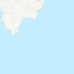
| cruise_area |
CP2 Regional Sea Boundaries: Western Channel & Celtic Sea, Offshore 1:250k: Lands End, SeaVoX Sub-Ocean: ENGLISH CHANNEL
|
| end_date |
2015-09-07 00:00:00
|
| cruise_data_url |
http://webapps.bgs.ac.uk/services/ngdc/accessions/index.html#item126131
|
| abstract |
The Manacles Marine Conservation Zone 2015 baseline survey. Sampling equipment: Drop camera and 0.1 m2 Mini-Hamon grab.Drop Camera survey collecting video and still images of the seabed habitats within The Manacles MCZ. Hamon Grab survey within The Manacles MCZ. These data are archived with the Marine Environmental Data and Information Network (MEDIN) Data Archive Centres (DACs) including the British Geological Survey (BGS) DAC for geology and geophysics, The Archive for Marine Species and Habitats Data (DASSH) and the United Kingdom Hydrographic Office (UKHO) bathymetry DAC.The full site data package (excluding raw bathymetry) is also available on request from BGS.
|