| id |
218 |
| ship |
MV Gorsethorn
|
| samp_equip_type |
None
|
| terms_of_use_url |
http://nationalarchives.gov.uk/doc/open-government-licence/version/3/
|
| client |
British Geological Survey
|
| start_date |
1985-04-18 00:00:00
|
| mdfileid_nerc_guid |
abc9f747-53a8-0f38-e044-0003ba9b0d98
|
| contractor |
British Geological Survey
|
| start_date_est |
Real
|
| cruise_data_url |
None
|
| cruise_area |
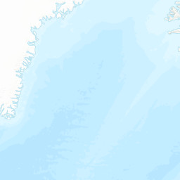
CP2 Regional Sea Boundaries: Northern North Sea, Scottish Continental Shelf, Offshore 1:250k: Bosies Bank, Caithness, Fair Isle, SeaVoX Sub-Ocean: NORTH SEA
|
| end_date |
1985-08-07 00:00:00
|
| abstract |
This British Geological Survey (BGS) marine geophysical survey took place in April and July-August 1985 in and around Fair Isle, Bosies Bank and the Outer Moray Firth on board the MV Gorsethorn. The purpose was to collect data as part of the UK continental shelf survey programme. Sea floor data were collected using echosounder. Sub-bottom seismic profiling data were collected using Airgun; Sparker; Pinger and Deep-tow Boomer. Gravity and Magnetometer data were recorded.These records are archived by BGS. Technical details of the survey are contained in BGS report WB/89/7R.
|
| end_date_est |
Real
|
| cruise |
1985/1
|
| additional_info |
Information for this survey is sourced from BGS report WB/89/7R. Vessel type - motor vessel. Navigation - Transit satellite, Magnavox integrated system, positions Internation Spheroid, European Datum 1950. Accuracy details - (Position +/- 200m in water depth <400m). Echo-sounder - Atlas Deso 20. Geophysical equipment: Magnetometer - Barringer M123; Gravity meter LaCoste and Romberg S75; Airgun; Sparker; Pinger; Deep-tow Boomer. Analgue recording. For more detailed information see the Cruise Report.
|
| confidentiality |
unclassified (open file)
|
| cruise_alias |
None
|
| nav_equip_type |
Transit satellite
|
| accessuse_restric |
unrestricted use, copyright acknowledgement
|
| restitle |
Geophysical Survey 1985/1: Northern North Sea (18/Apr/1985 to 07/Aug/1985)
|
| geophys_equip_type |
Airgun/Sleeve Gun, Deep Tow Boomer, Deep Tow Sparker, Echo Sounder, Gravimeter, Magnetometer, Pinger, Sidescan Sonar, Sparker, Water Gun
|
| terms_of_use |
Available under the Open Government Licence subject to the following acknowledgement accompanying the reproduced British Geological Survey materials "Contains British Geological Survey materials ©UKRI [year]"
|