| id |
308 |
| restitle |
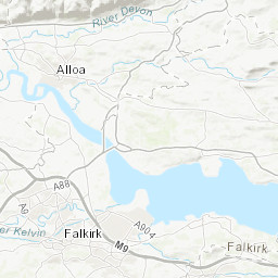
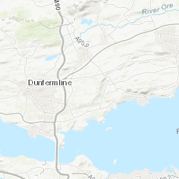
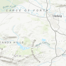
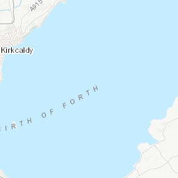
Geophysical and Multibeam Survey 2005/1: Firth of Forth (01/Mar/2005 to 03/Mar/2005)
|
| geophys_equip_type |
Multibeam, Surface Tow Boomer
|
| terms_of_use |
Available under the Open Government Licence subject to the following acknowledgement accompanying the reproduced British Geological Survey materials "Contains British Geological Survey materials ©UKRI [year]"
|
| ship |
MPV Teal
|
| samp_equip_type |
None
|
| terms_of_use_url |
http://nationalarchives.gov.uk/doc/open-government-licence/version/3/
|
| mdfileid_nerc_guid |
abc9f747-5356-0f38-e044-0003ba9b0d98
|
| client |
British Geological Survey
|
| start_date |
2005-03-01 00:00:00
|
| contractor |
Fathoms Ltd
|
| start_date_est |
Real
|
| cruise_data_url |
None
|
| cruise_area |
CP2 Regional Sea Boundaries: Northern North Sea, Offshore 1:250k: Borders, Tay-Forth, SeaVoX Sub-Ocean: NORTH SEA
|
| end_date |
2005-03-03 00:00:00
|
| abstract |
This British Geological Survey (BGS) marine geophysical and multibeam survey took place in March 2005 in the area underneath and around the Forth bridges on board Fathoms Ltd's Multi Purpose Vessel Teal. The purpose was to obtain complete bathymetric coverage of the area between the Forth bridges, except where it was too shallow for safe operations. Multibeam bathymetry data were collected using a Reson Seabat 8125 run by Fathoms Ltd and the processed output supplied to BGS. Sub bottom seismic profiling data were gathered by BGS using a surface tow boomer. A magnetometer was also used. Most of the data were recorded digitally, but paper records were generated also. These data are archived by BGS. Technical details of the Multibeam survey are contained in Fathoms Report c104281 (nonBGS report 2007/3).
|
| end_date_est |
Real
|
| cruise |
2005/1
|
| additional_info |
For more detailed information on the acquisition equipment and data collection techniques, operational standards, data processing methods and quality control procedures used on this survey see the Report of Survey/Cruise Report and associated documentation where available. The information available may vary depending on the age of the survey. Data are checked and loaded to the BGS Coastal and Marine data management system following BGS marine data management procedures.
|
| confidentiality |
unclassified (open file)
|
| cruise_alias |
Firth of Forth
|
| nav_equip_type |
Differential GPS
|
| accessuse_restric |
unrestricted use, copyright acknowledgement
|